
The Spanish Pyrenees extend roughly 430 kilometres from the Atlantic coast at Cabo Higuer (Hondarribia) to the Mediterranean shore near Portbou. The range rises to 3,404 metres at Aneto, the highest summit in the Pyrenees. The Spanish side encompasses six administrative provinces and includes two national parks, multiple natural parks and a network of long-distance trails maintained under the national FEDME classification system.
Trail Classification in Spain
Spain uses a standardised trail marking system established by FEDME (Real Federación Española de Deportes de Montaña y Escalada). Three principal categories apply across the Pyrenees:
| Category | Code | Marking | Typical Length |
|---|---|---|---|
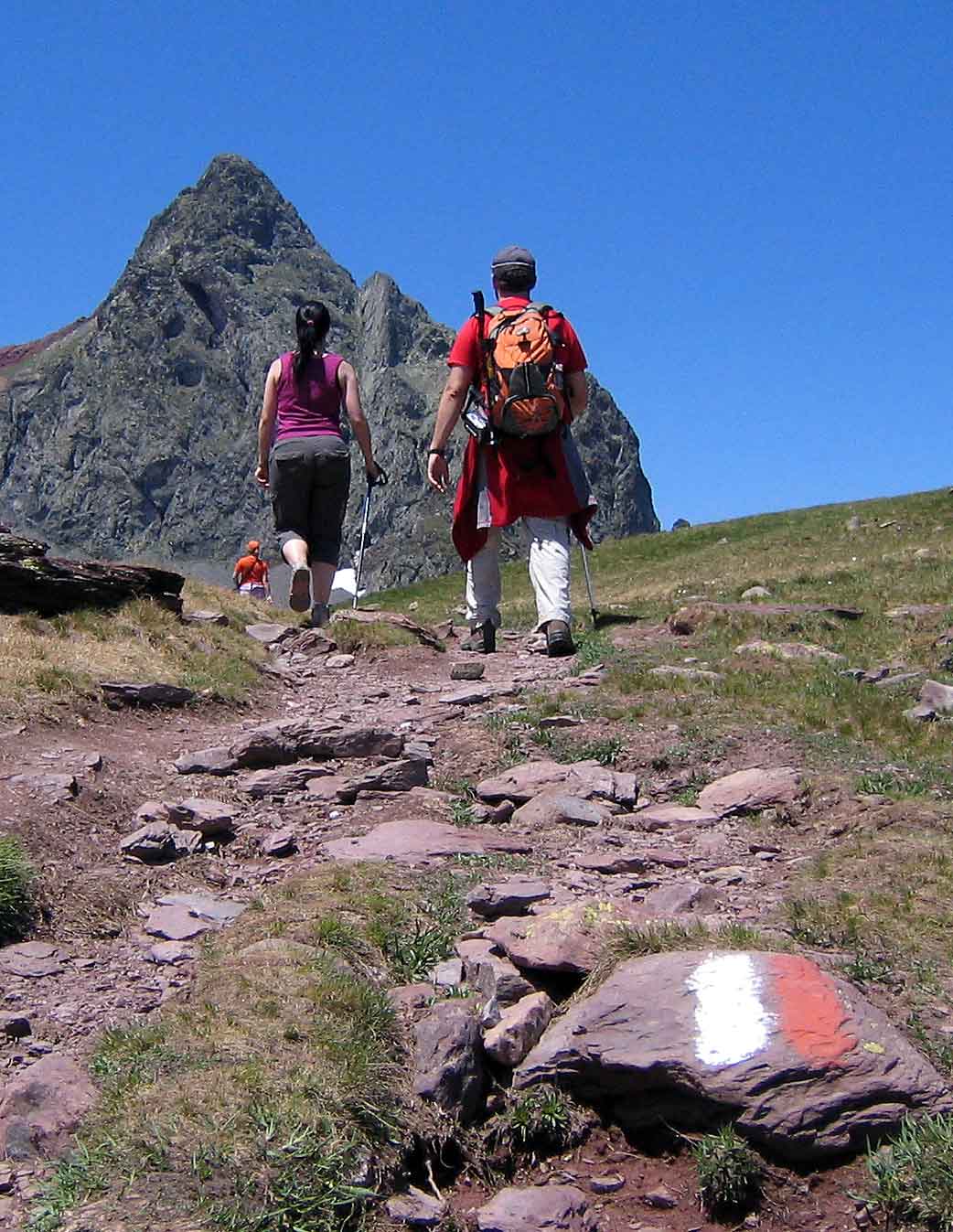
| Long-distance route (Gran Recorrido) | GR | White & red stripes | > 50 km |
| Medium-distance route (Pequeño Recorrido) | PR | White & yellow stripes | 10–50 km |
| Local route (Senda Local) | SL | White & green stripes | < 10 km |
The GR-11: Transpyrenean Route
The GR-11, known as the Senda Pirenaica or Ruta de los Pirineos, is the principal long-distance trail running the full length of the Spanish Pyrenees. It covers approximately 820 kilometres across 45 stages and passes through three autonomous communities: the Basque Country, Navarre, Aragon and Catalonia.
The GR-11 is entirely within Spanish territory, unlike the Haute Route Pyrénéenne (HRP) which crosses into France. This makes it a logistically simpler option for travellers based in Spain. The official route is documented by Senderos de España.
The standard walking direction is west to east. Most walkers complete the full route in 40 to 50 days, though the trail is commonly tackled in sections. The route passes through or near the following population centres and infrastructure points:
- Hondarribia (start) — access by bus from San Sebastián Irun railway station
- Elizondo — services in the Baztan valley, Navarre
- Isaba — mountain hut and resupply point in Roncal valley
- Candanchú / Astun — ski resort with summer accommodation
- Benasque — major logistical hub in the central Pyrenees
- Espot — gateway to Aiguestortes national park
- Portbou (end) — rail connection to Barcelona
National Parks and Access Regulations
Two national parks fall within the Spanish Pyrenees. Both impose specific access conditions that vary by zone and season.
Ordesa y Monte Perdido (Huesca)
Designated in 1918, Ordesa y Monte Perdido was Spain’s first national park. The core zone encompasses four major valleys: Ordesa, Añisclo, Escuaín and Pineta. The main trailhead at Pradera de Ordesa has restricted vehicle access during peak summer months (mid-July to August). The park authority operates a shuttle bus service from Torla-Ordesa village.
Key trail information:
- Faja de Pelay: a high-level traverse at approximately 1,900 m offering full valley views
- Cola de Caballo route: valley floor trail to the main waterfall (approx. 9 km one-way)
- Circo de Cotatuero: technical approach requiring scrambling, not marked as a standard trail
Aiguestortes i Estany de Sant Maurici (Lleida)
Located in the Pyrenean range of the Pallars Sobîra and the Alta Ribagorça, this park protects a glacially formed landscape with numerous lakes. Vehicle access into the park interior requires use of official taxis (4WD vehicles operated by the local authority). Private vehicles stop at Espot (eastern entrance) or Boí (western entrance).
The park has no through roads. Most trails follow lake circuits and mountain passes. Overnight camping within the park boundary is not permitted; mountain huts (refugis) provide paid accommodation and require advance booking in summer.
Mountain Huts (Refugios)
The Spanish Pyrenees have an extensive network of mountain huts operated under the membership system of the FEDME and affiliated regional clubs (FAM, Federación Aragonesa de Montañismo). Huts vary from basic unstaffed shelters (bivouacs) to fully staffed refugios offering meals and dorm accommodation.
| Hut Name | Altitude | Area | Operator |
|---|---|---|---|
| Refugio de Goriz | 2,200 m | Ordesa NP | FAM |
| Refugio Venasque | 2,448 m | Benasque area | FAM |
| Refugio d’Amitges | 2,380 m | Aiguestortes NP | FEEC |
| Refugio de Lizara | 1,540 m | Hecho valley, Huesca | FAM |
Seasonal Access and Conditions
The Pyrenean trails are generally accessible between late May and mid-October. High-altitude passes above 2,400 m may retain snow into June and can become impassable after early autumn snowfall. The following seasonal notes apply to most routes:
- Spring (April–May): Lower valleys accessible; high passes snow-covered. River crossings may be problematic due to snowmelt.
- Summer (June–September): Peak season; all standard trails open. Thunderstorm risk increases in afternoons from July onwards.
- Autumn (October–November): Stable conditions in September; snowfall from October can close high routes.
- Winter (December–March): Only for equipped mountaineers. Most refugios closed.
Current trail conditions and park access restrictions are published by the Red de Parques Nacionales and individual autonomous community park authorities. Always verify access before departing.
External References
- FEDME — Real Federación Española de Deportes de Montaña y Escalada
- Ordesa y Monte Perdido National Park
- Aiguestortes i Estany de Sant Maurici (Generalitat de Catalunya)

